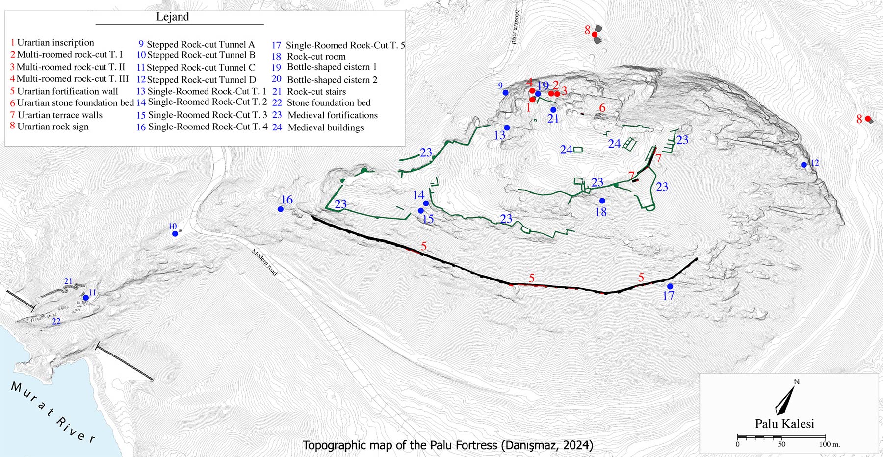
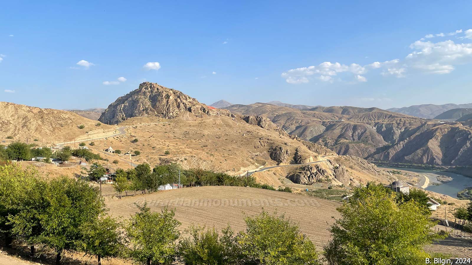
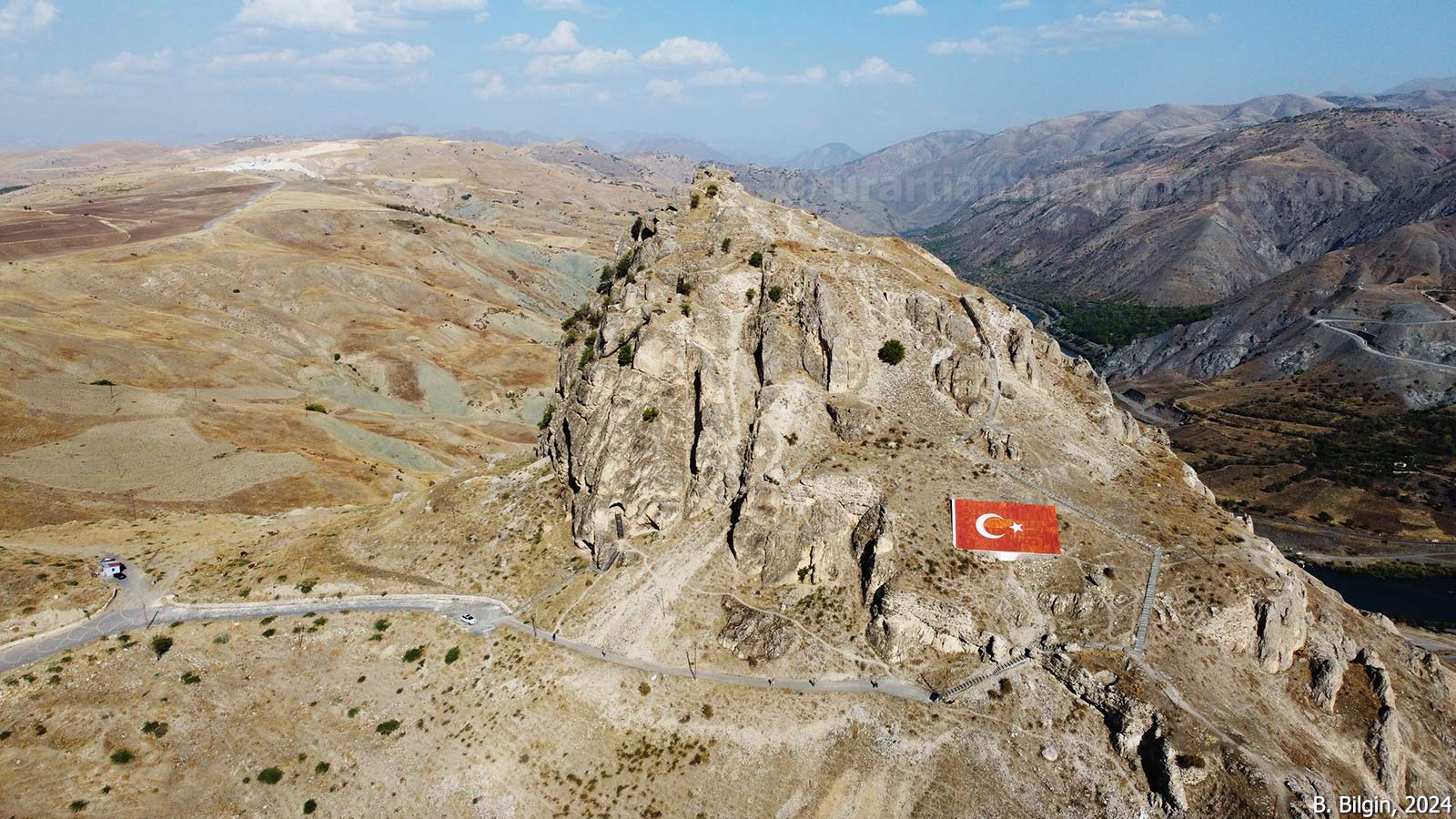
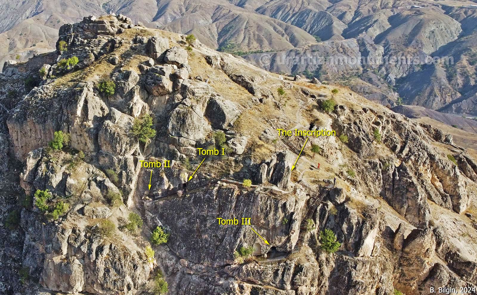
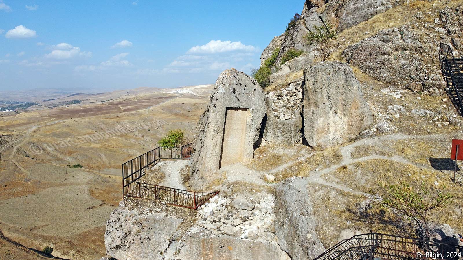
It is a Urartian fortress built on a hill approximately 2 km west of the Palu district center. To the south, the Murat River curves around the hill like a crescent and extends eastward. The north and west sides of the hill consist of steep and rugged cliffs that provided natural defensive advantages.
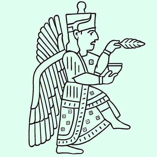
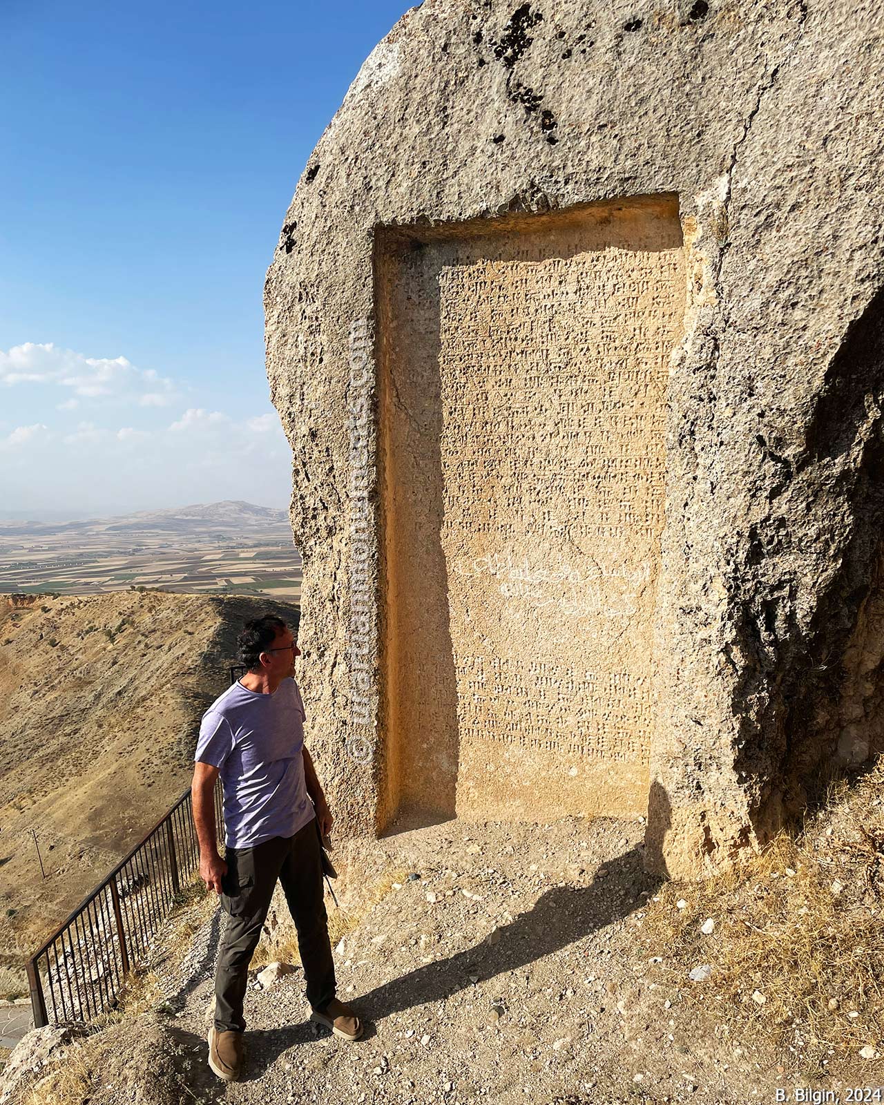
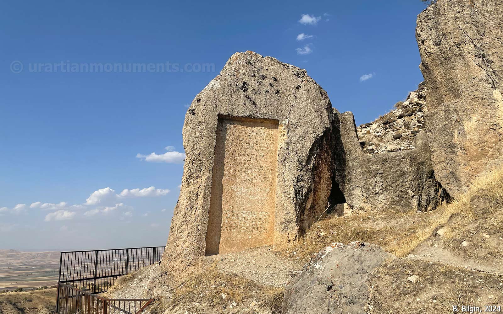
An inscription (A 5-5) located in a large rock niche at the top of the hill indicates that the fortress was founded by the Urartian King Minua (r. 785/780–756 BCE) and that its name was Šebeteria. The mention of a Haldi temple built by King Minua in this city suggests that Šebeteria (Palu) was the center of the Alzi (Elazığ) region. The same inscription also states that Minua forced the western neighbor, the Kingdom of Melitene (present-day Malatya), to pay tribute. This implies that the Urartian Kingdom had asserted its authority over the western border region.
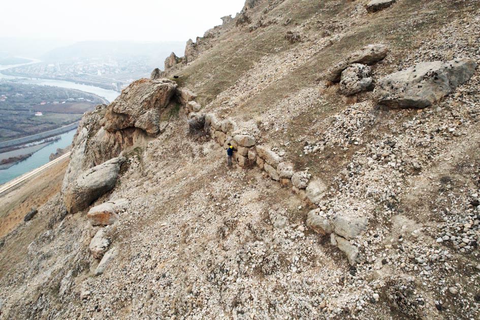
Although Minua’s grand inscription has been known since the 19th century and some researchers have studied the site—especially on the rock tombs—official excavations just only started in 2025. The fortress experienced significant construction activity particularly during the Medieval period; however, it was abandoned following the severe damage caused by a major earthquake at the end of the 18th century. Aside from the inscription and the tombs, the only architectural traces from the Urartian period consist of terrace wall foundations visible at several points on the southern slope.
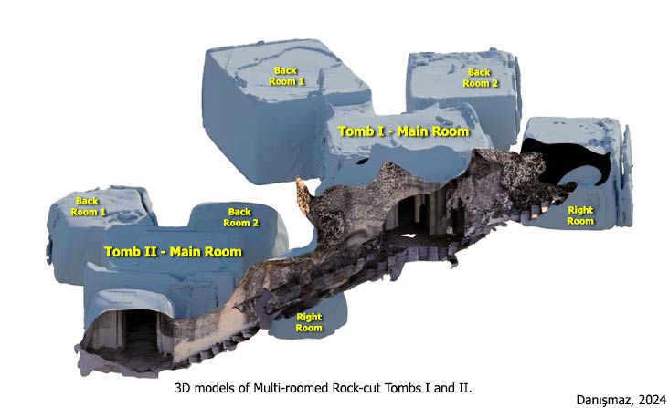
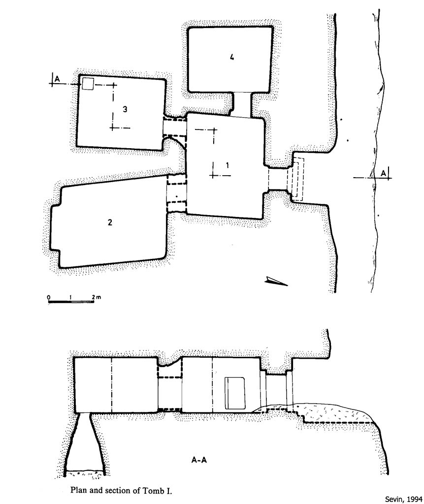
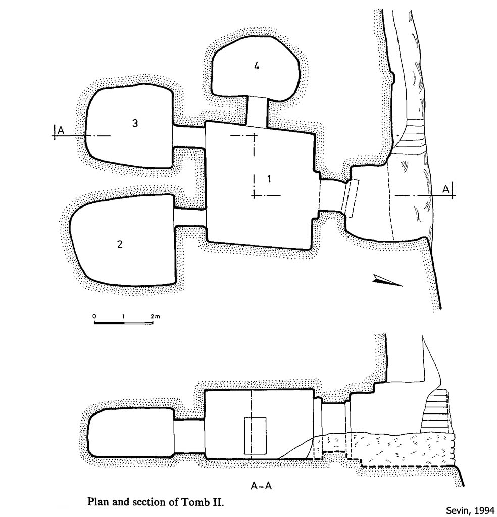
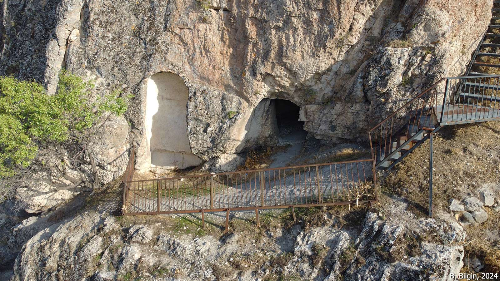
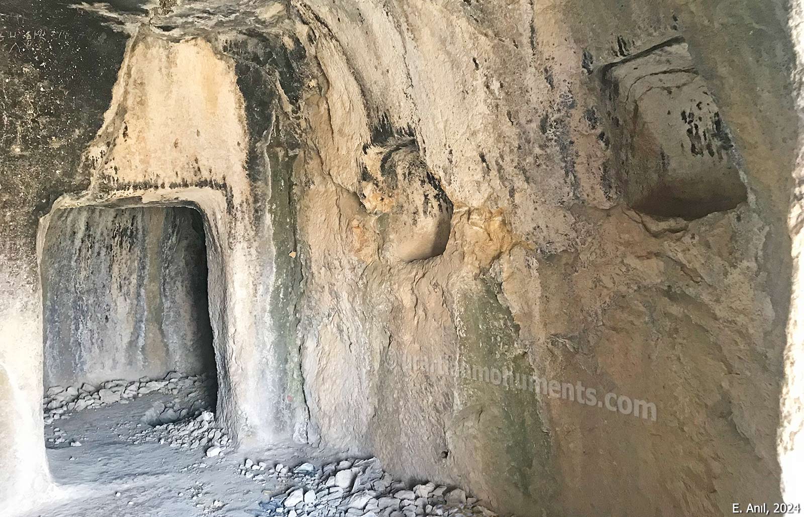
On the northern slope of the fortress, there are three rock tombs reminiscent of the royal tombs at Van Fortress. They are accessed by staircases carved into the bedrock from the top of the cliff. Two of these tombs, located further east and sharing the same stairway, are multi-roomed and have similar layouts. The higher one is referred to as Tomb I, and the other as Tomb II. Both feature vaulted entrances and contain three rooms: two opening from the back wall of the main chamber, and a third from the right-hand wall. Tomb I, situated at a higher elevation, is believed to be older and shows finer workmanship. In the rear left chamber of this tomb, there is a bottle-shaped well with a rectangular mouth is carved into the floor. Similar rock tombs with a well inside have also been discovered in Kayalıdere, Atabindi (Ağrı, Tutak), and Marifet (Erzurum, Pasinler). The rear rooms in Tomb II appear to have been left unfinished.
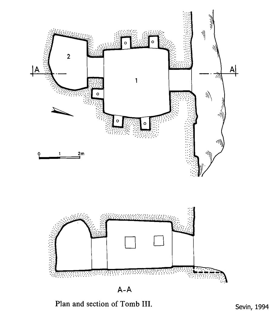
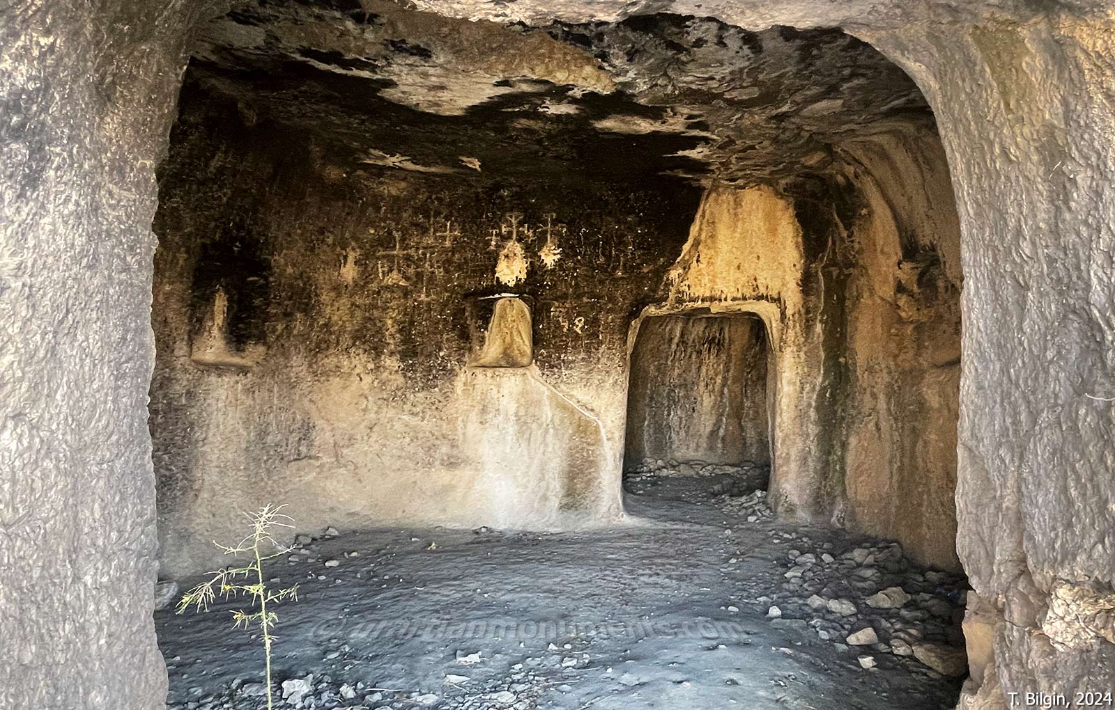
Tomb III, which lies lower on the slope and is accessed by a separate stairway, consists of two successive rooms. The walls of the first room contain five niches, believed to have held urns containing cremated remains. Accordingly, circular hollows were carved into the floors of each niche to hold these urns.
According to researcher V. Sevin, Tomb III was constructed later than the others. He dates all three tombs to the reign of Argišti I and the period that followed.
To the left of Tomb III’s entrance, a tall niche has been carved, with a socket in its floor likely intended for a stele. This feature suggests that the area may have served a ritual or cultic purpose connected to the tomb.
References:
Çevik, N. 1996. Şebeteria – Batı Urartu’da Bir Kent ve Kaya Anıtları, Yüksek Lisans Tezi, Atatürk Üniversitesi Sosyal Bilimler Enstitüsü, Erzurum.
Danışmaz, H. 2024. “A Provincial Centre on the western border of Urartu: Palu Fortress,” Anadolu Araştırmaları / Anatolian Research 30, 131-166.
Köroğlu, K. 2022. “Urartu Krallığı’nın Elazığ ve Çevresindeki Yerleşim Politikası,” in Ülker Ardıçoğlu’na Armağan: Müzeciliğe ve Kültüre Adanmış Bir Ömür, ed. O Hetto, İstanbul.
Sevin, V. 1994. “Three Urartian Rock-Cut Tombs from Palu,” Tel Aviv 21/1, 58-67.
Image sources:
H. Danışmaz, 2024
Ertuğrul Anıl, 2024
Bora Bilgin, 2024
Tayfun Bilgin, 2024