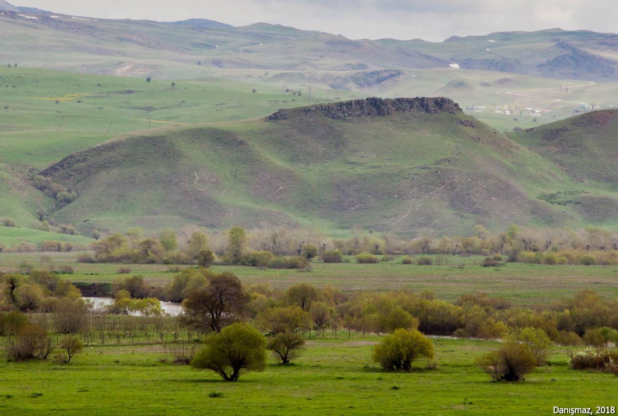
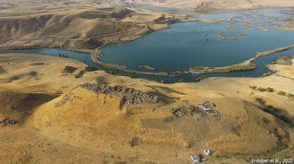
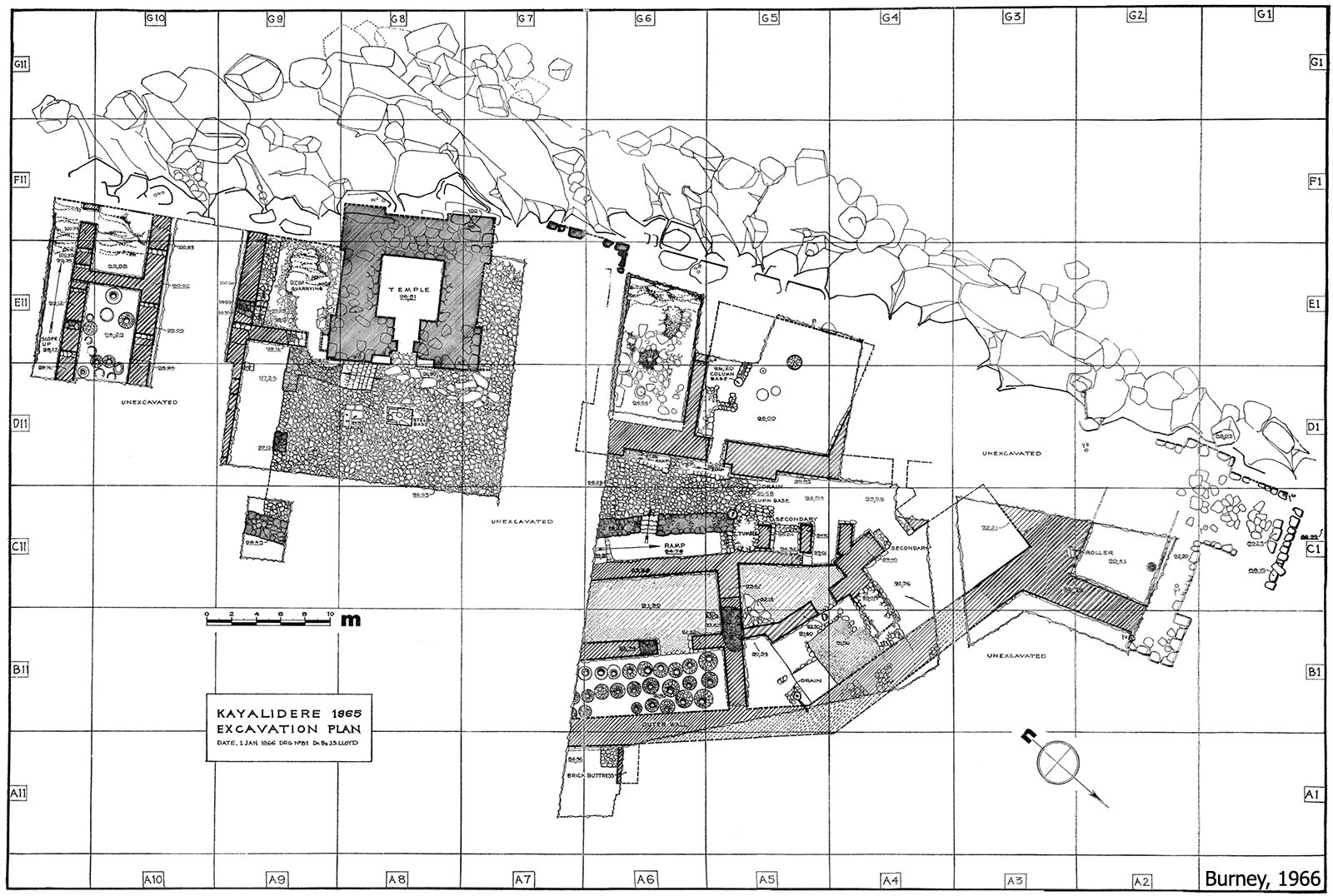
Kayalıdere Fortress, located about 1.5 km west of Kayalıdere village in the Varto district, is one of the provincial centers that controlled the western regions of the Urartian Kingdom. It was built on a rocky ridge extending in a northwest-southeast direction along the banks of the Murat River (Eastern Euphrates).
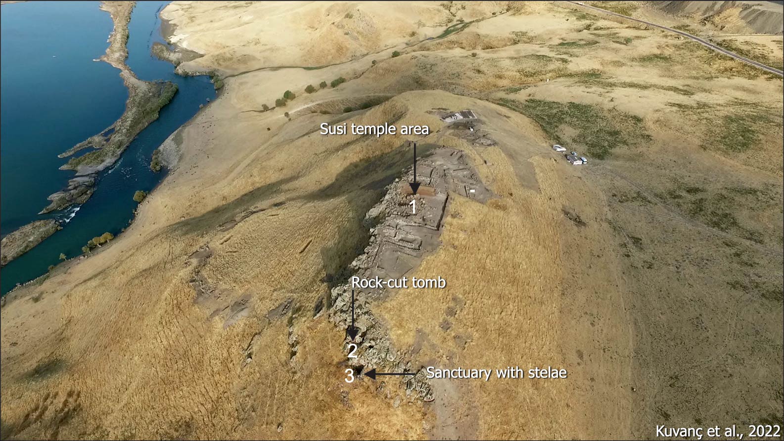
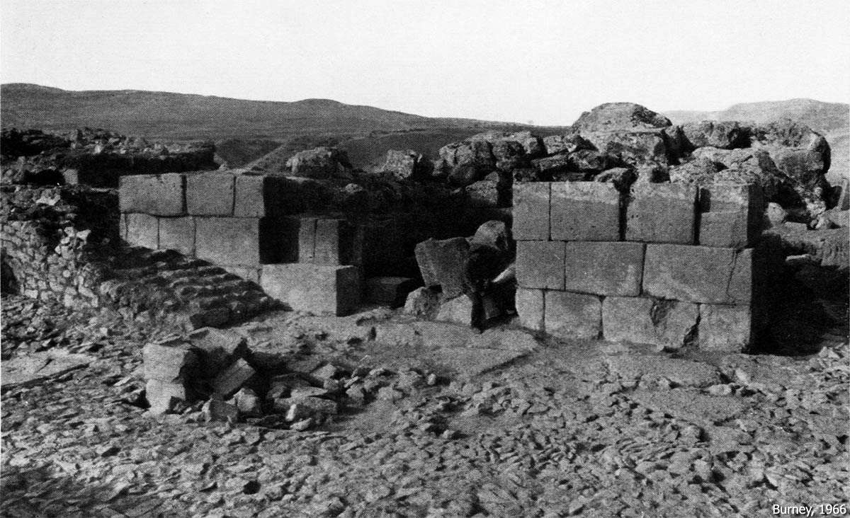
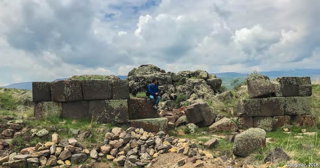
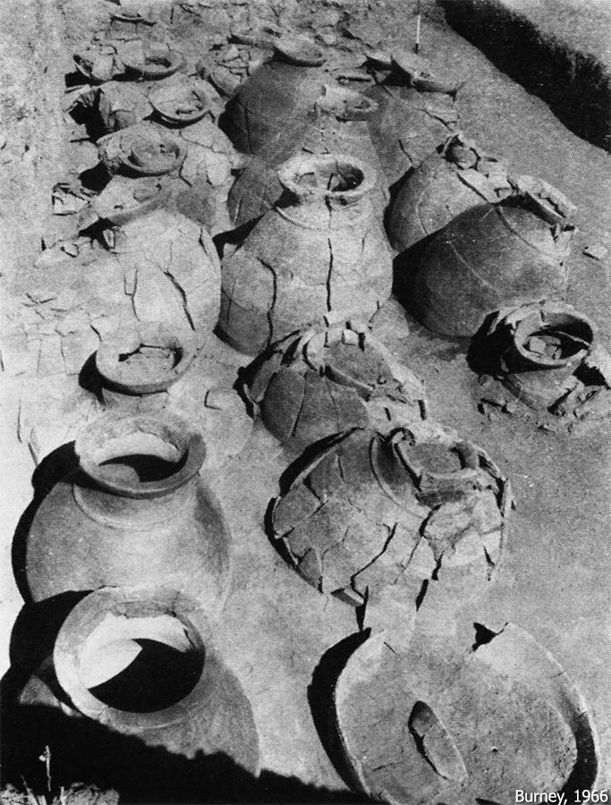
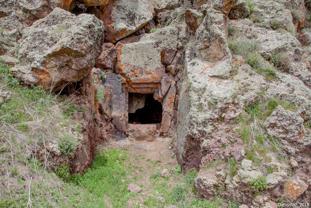
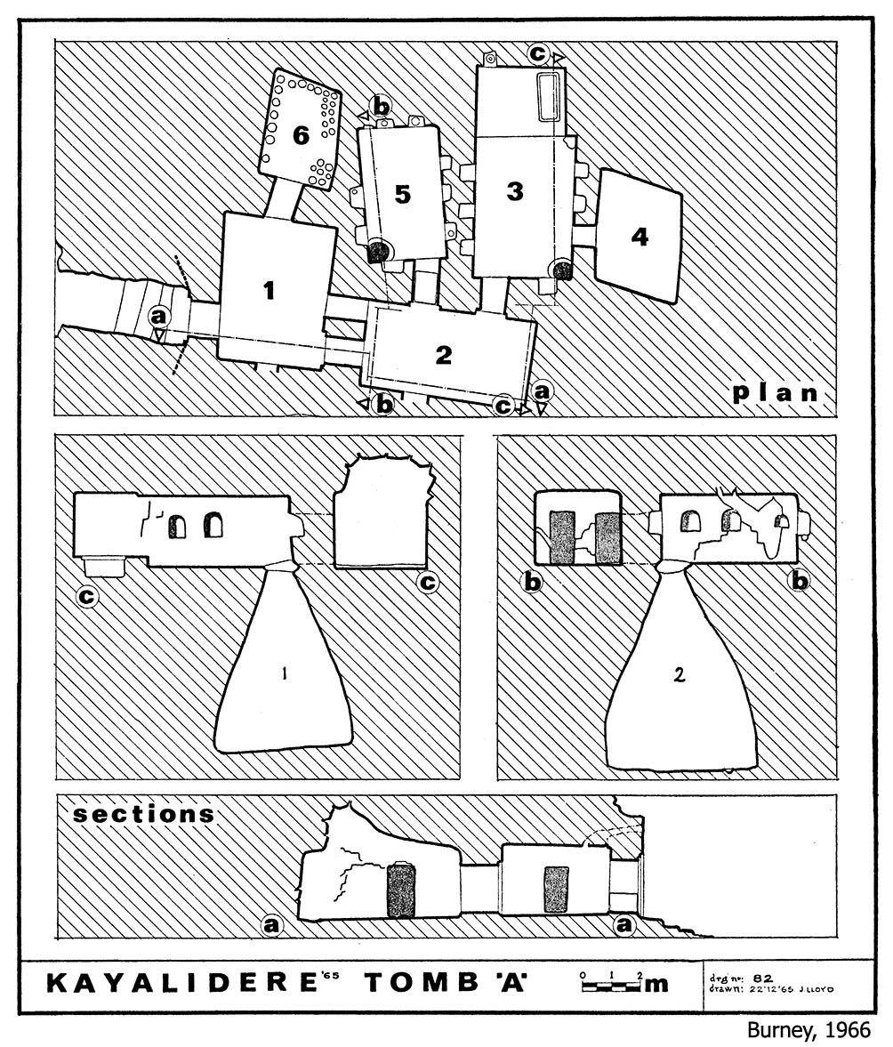
The site was first identified during surface surveys conducted in 1964. The first scientific excavations were carried out in 1965 by S. Lloyd and C. A. Burney, although only for a single season. These investigations revealed a temple and storage facilities with pithoi at the summit of the hill, while a multi-chambered rock-cut tomb was identified on its southeastern slope.
The rock-cut tomb consists of six interconnected burial chambers. In two of these chambers, wells were identified, similar to those documented at Palu, Atabindi (Ağrı/Tutak) and Marifet (Erzurum/Pasinler). The purpose of these wells remains a subject of debate, with differing interpretations suggesting either ritual functions or use for the collection of refuse. The Kayalıdere tomb is the only known example that contains more than one well.
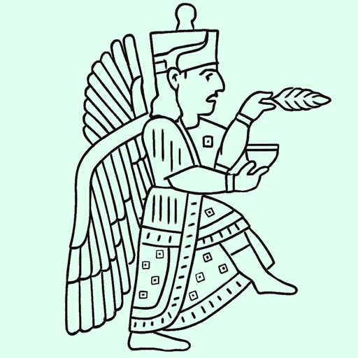
Among the small finds uncovered during the excavations are many engraved metal objects and decorative pieces; however, no inscription has been discovered.
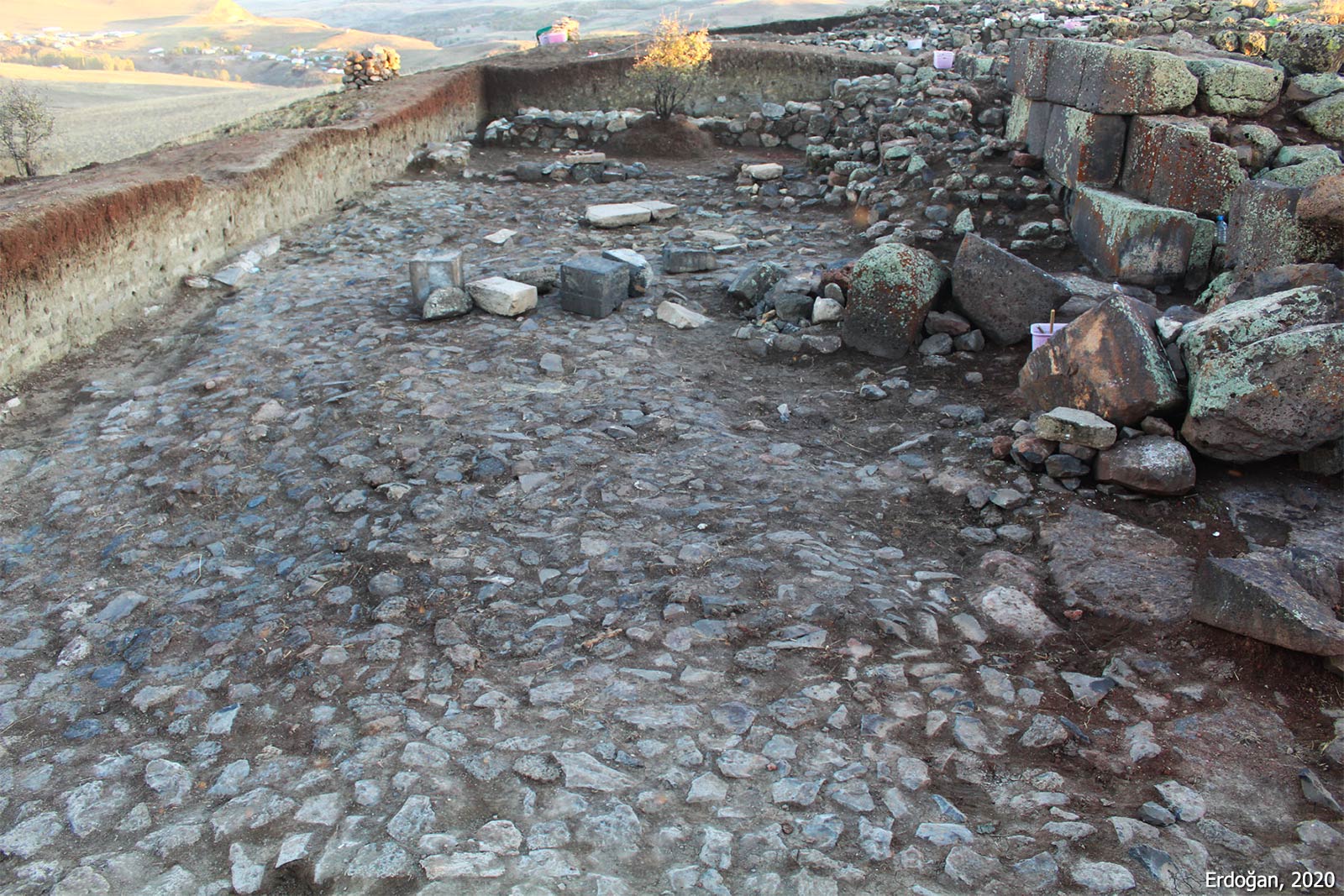
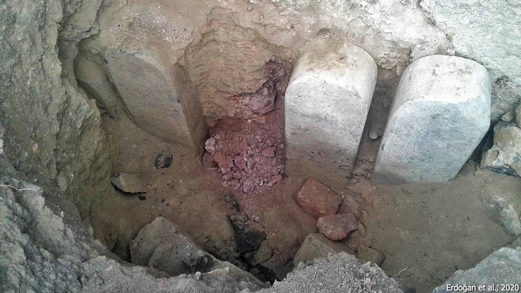
Fifty-three years after this single season of excavation, rescue excavations were carried out in 2018–2019 as the settlement of Kayalıdere faced the threat of submersion beneath the waters of the Alparslan II Dam on the Murat River. The most significant discovery of these recent excavations was a cult area with stelae, located adjacent to the rock-cut tomb on the southeastern slope of the hill. Due to illegal excavations, all of the stelae were destroyed, with only partially preserved bases remaining. It is estimated that the original number of stelae was seven. Interpreted as a type of open-air sanctuary, comparable examples are also attested at Altıntepe, Aznavurtepe, and Yeşilalıç. The fact that the cult area at Kayalıdere, like that at Altıntepe, was established at a lower level than the citadel walls and in direct association with a tomb suggests that the rituals conducted here may have been connected with funerary practices.
Since no inscription has yet been found in the surface surveys and excavations carried out at Kayalıdere, it cannot be determined with certainty when it was built. Based on its architectural features, it is estimated to have been constructed in the late 9th century BCE or the early 8th century BCE.
References:
Burney, C. A. 1966. “A First Season of Excavations on the Urartian Citadel of Kayalıdere,” Anatolian Studies 16, 55–111.
Çevik, N. 2000. Urartu Kaya Mezarları ve Ölü Gömme Gelenekleri, Türk Tarih Kurumu, Ankara.
Danışmaz, H. 2018. Arkeolojik Veriler Çerçevesinde Urartu Krallığı’nın Eyalet Sistemi, Yayınlanmamış Doktora Tezi, İstanbul Üniversitesi, İstanbul.
Erdoğan, S., M. Ercek & M. Şen. 2020. “Kayalıdere Kalesi 2018-2019 Yılı Kurtarma Kazıları: İlk Notlar,” Aras Türkiye Eski Yakın Doğu Araştırmaları Dergisi 2, 19–37.
Ercek, M., et al. 2023. “Muş ili, Varto İlçesi, Kayalıdere Kalesi 2018-2019 Yılı Kurtarma Kazıları,” in 2018-2020 Yılı Kurtarma Kazıları, KVMGM 198, Ankara, 341–352.
Kuvanç, R., K. Işık, B. Genç & E. Konyar. 2022. “Urartian Cult of the Stelae and New Discoveries at Aznavurtepe and Yeşilalıç (Ashotakert),” JANER 22, 55–88.
Lloyd, S. & C. A. Burney, 1967. “Excavations at the Urartian Citadel of Kayalıderedere (1965 Season),” Türk Arkeoloji Dergisi, 14.1–2, 217–222.
Images:
C. A. Burney, 1966
H. Danışmaz, 2018
N. Çevik, 2000
S. Erdoğan et al., 2020
R. Kuvanç et al., 2022