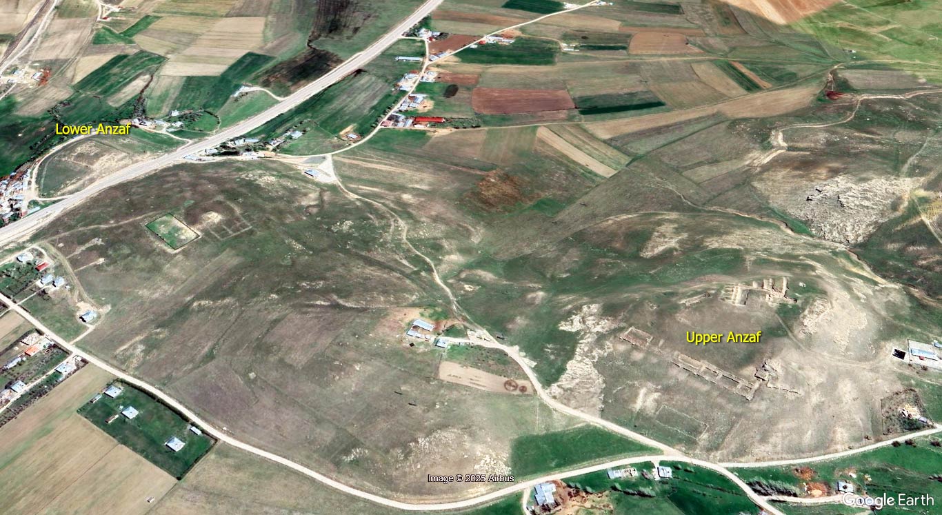
The fortresses of Upper Anzaf (Yukarı Anzaf) and Lower Anzaf (Aşağı Anzaf) represent a critical architectural and strategic complex from the Urartian period, located approximately 10 km northeast of Van in eastern Turkey. These fortified sites were constructed during the reigns of Kings Išpuini and Minua in the 9th–8th centuries BCE and served both military and administrative functions along a key route toward the Iranian plateau.
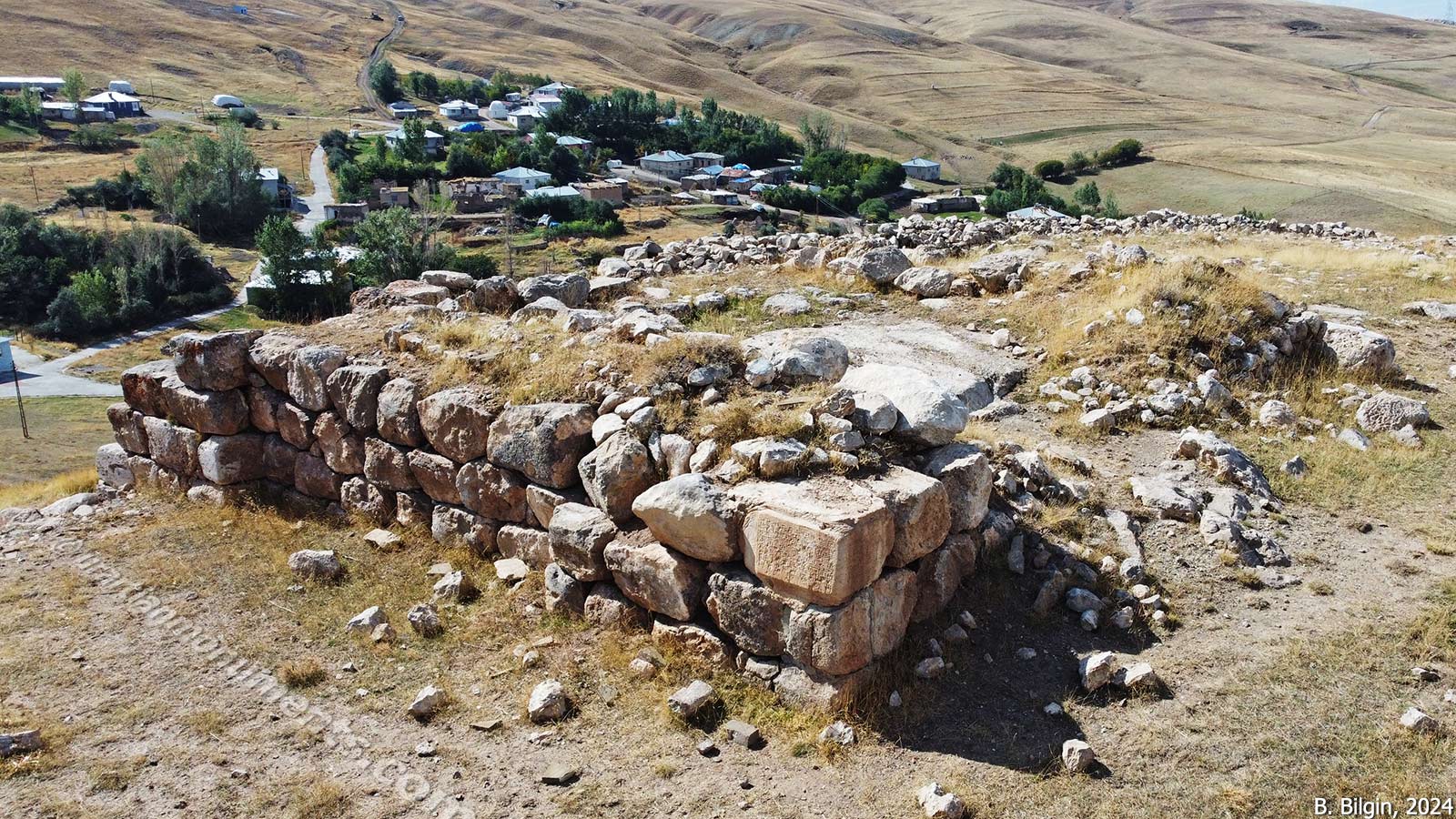
Lower Anzaf Fortress is attributed to King Išpuini and is characterized by a rectangular ground plan (approx. 62 × 98 meters) and robust cyclopean limestone masonry. The fort lacks internal architectural complexity, reinforcing the interpretation that it functioned primarily as a defensive and logistical outpost guarding access to eastern trade and military corridors. The southern gate and portions of the wall have been damaged by modern infrastructure development.
Upper Anzaf Fortress, constructed during the reign of King Minua, occupies a 6-hectare area atop a rocky elevation and is enclosed by cyclopean walls fortified with bastions and two main gates (north and south). The northern gate leads to functional spaces such as workshops and storage areas, while the southern entrance opens to the religious and administrative center.
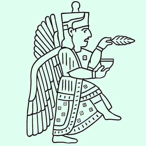
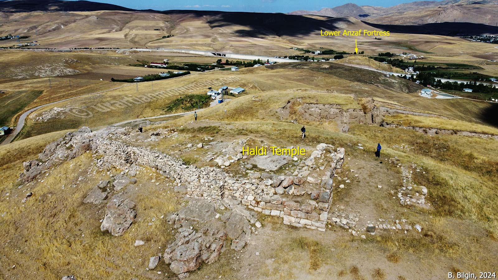
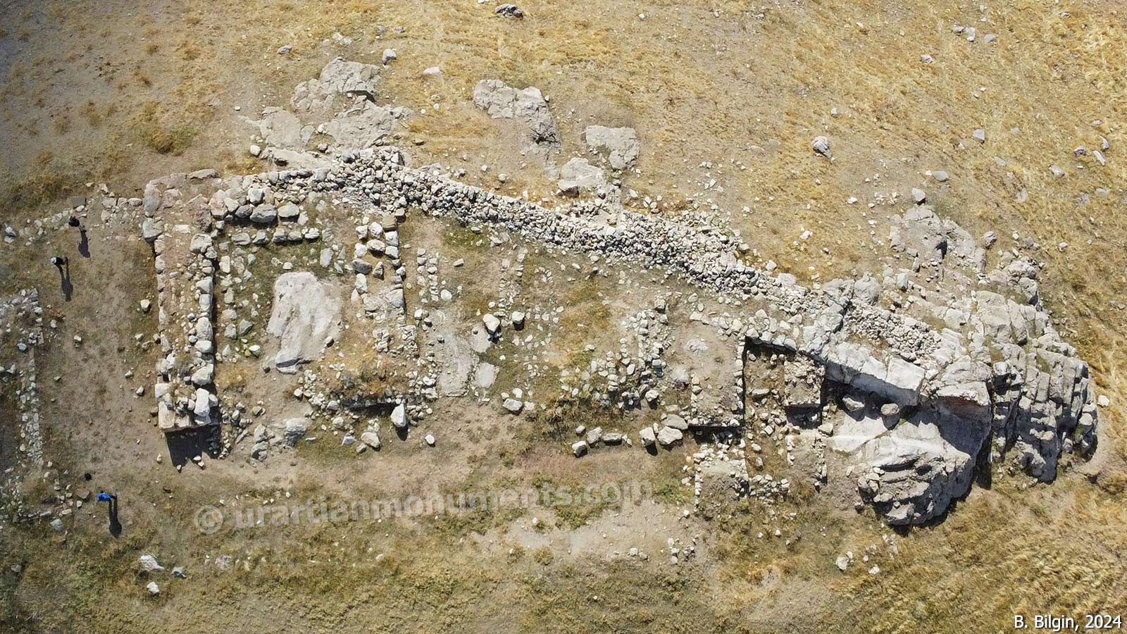
At the highest point of the fortress lies a temple dedicated to the god Haldi, marked by an inscription (A 5-42) in which Minua proclaims the construction of the fortress and temple under Haldi’s authority. Adjacent to the temple is a palatial complex, including a reception hall (10 × 29 meters) with column bases and subsidiary rooms. Storage facilities in proximity yielded over a hundred pithoi—some inscribed with cuneiform texts and royal seals—confirming the site’s role as a regional provisioning and bureaucratic hub.
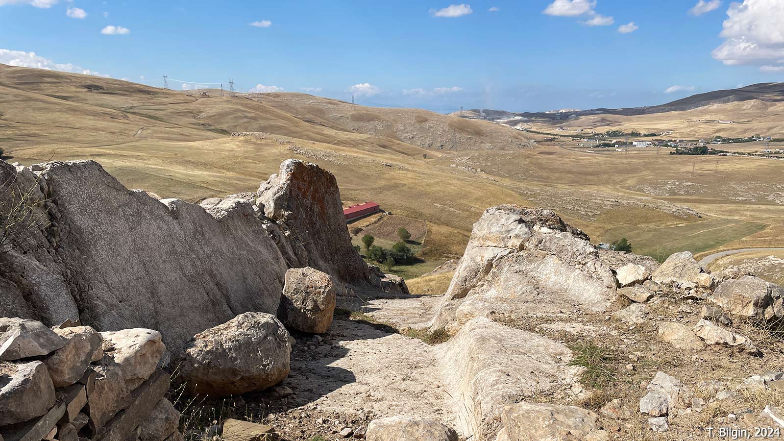
The Anzaf Fortresses formed a crucial node within the Urartian defensive and administrative system, overseeing a trade route connecting Tušpa (modern Van) to the Lake Urmia Basin and Kotur Valley. While Lower Anzaf maintained military control over movement in the Gürpınar–Muradiye corridor, Upper Anzaf functioned as a provincial capital, complete with religious, bureaucratic, and storage functions. The potential existence of a lower urban settlement covering 20 hectares south of the citadel further supports its elevated administrative role.
Systematic excavations, led by Oktay Belli since 1991, have clarified the site’s architectural sequence and inscriptions. Nonetheless, preservation issues persist: especially at Upper Anzaf, where exposure to rain and snow after the cessation of fieldwork in the late 2000s has led to deterioration of mudbrick structures.
The Anzaf Fortresses present an exemplary case of Urartian fortification architecture and provide critical insight into the kingdom’s mechanisms of territorial governance, religious cult practices, and logistics. Upper Anzaf, in particular, stands out for its monumental architecture and rich epigraphic record, further illuminating the role of regional centers within the broader Urartian state.

References:
Belli, O. 2000. “Aşağı ve Yukarı Anzaf Urartu Kaleleri Kazısı,” in Türkiye Arkeolojisi ve İstanbul Üniversitesi (1932-1999), ed. O. Belli, Ankara, 201–209.
Belli, O. & A. Ceylan. 2004. “2003 Yılı Aşağı ve Yukarı Anzaf Urartu Kaleleri Kazısı,” KST 26.1, Konya, 175–188.
Belli, O., A. Dinçol & B. Dinçol. 2004. “Royal Inscriptions on Bronze Artifacts from the Upper Anzaf Fortress at Van,” Anatolica 30, 1–14.
Belli, O., A. Dinçol & B. Dinçol. 2005. “Bronze Door Rings with Cuneiform Inscriptions of Sarduri II from the Upper Anzaf Fortress,” Anatolica 31, 217–226.
Gökçe, B., R. Kuvanç & B. Genç, 2021. “Lake Van Basin Urartian Period Road Routes Survey: First Preliminary Report (2017–18), Muradiye and Tuşba Districts,” Tarih İncelemeleri Dergisi 36.1, 137–162.
Işık, K. 2015. “Yeni Keşfedilen Bir Urartu Yazıtı Işığında Yukarı Anzaf Kalesi Susi Tapınağı Yazıtları,” Colloquium Anatolicum 14, 61–71.
Image sources:
Tayfun Bilgin, 2024
Reha Özer, 2024
Bora Bilgin, 2024
Google Earth, 2025